Est. 2005 · UK-wide trenchless installations07920 553 578·enquiries@swdirectionaldrilling.co.uk
Crossing Solutions
A crossing under a river is a regulatory job as much as a drilling one. We design the crossing to stay inside the Environment Agency's FRA3 exemption, so it is a simple registration rather than a full permit, and see the approval through.
Drilling a service beneath a river keeps the work out of the channel entirely. We launch from a pit set back on one bank, steer the bore well below the bed, and receive it on the far side, so nothing is dug across the river and the bed and banks are left alone. It is the Environment Agency’s rules, more than the drilling, that decide how the job runs, so we design the crossing around them first.
The Agency controls work in, under, over or near a main river, the larger rivers and streams it shows on its main river map. A crossing below the bed of a main river is a flood risk activity, and it would normally need a full Flood Risk Activity Permit. A trenchless crossing, though, usually qualifies for exemption FRA3, "a service crossing below the bed of a main river not involving an open-cut technique". Meet the FRA3 conditions and the crossing is a registrable exemption instead of a permit, which is quicker, free, and does not sit on the programme. So the whole design is aimed at staying inside them.
To register the crossing as exempt, all of these have to be met:
That 1.5m is the threshold to be exempt, not automatically the right depth for the river. On a deep, wide or scour-prone crossing the Agency commonly wants more cover, set case by case against the scour depth and bed profile, so we confirm the required minimum and the datum it is measured from before fixing the bore. How the whole process runs, from the early protected-site check through the surveys, the design, the registration and the works, is walked through in our stage-by-stage FRA3 guide.
If a crossing cannot meet every FRA3 condition, the pits too close to the bank, the alignment more than 10 degrees off, less than the required cover, too near an impoundment, then the exemption does not apply and a full Flood Risk Activity Permit is needed. That is a determination rather than a registration: the Agency normally decides within 2 months for a flood-risk-only application, longer if it is combined with other activities, and there is a charge. We build that window into the programme, hold a pre-application discussion with the Agency, and either make the application with our design behind it or support the client in taking it out.
Not every channel is a main river or a canal, and the consent changes with what you are crossing:
In Wales the regime is the same, run by Natural Resources Wales. Scotland is different: SEPA works to the Controlled Activities Regulations, so the England-and-Wales figures do not carry across, and we check the SEPA rules for a Scottish crossing.
What we handle
| Regulator | The Environment Agency for a main river; the lead local flood authority or internal drainage board for an ordinary watercourse; the Canal & River Trust for a canal |
|---|---|
| The exemption | EA exemption FRA3, "a service crossing below the bed of a main river not involving an open-cut technique", a registrable exemption instead of a full permit |
| Depth below the bed | At least 1.5m below the riverbed for the whole length, held for 5m beyond each bank, to qualify. Deep or scour-prone rivers need more, set with the EA |
| Alignment | Bore within 10 degrees of perpendicular to the flow, with the launch and reception pits 8m or more from the bank (16m if tidal) |
| Registration | The exemption is registered online before work starts. It is free, with no determination period, so it does not sit on the programme like a permit does |
| What we handle | The bathymetric bed survey and the crossing design that proves the conditions. We can include the registration, or the permit application, though it is often made by the asset owner or main contractor, with our design behind it |
| Track record | A 252m crossing under the tidal River Parrett at Pawlett Hams, drilled around 5m beneath the bed, well inside the FRA3 depth |
The 1.5m depth is the exempt threshold; deep or scour-prone rivers need more, confirmed with the Environment Agency.
A crossing we designed to FRA3
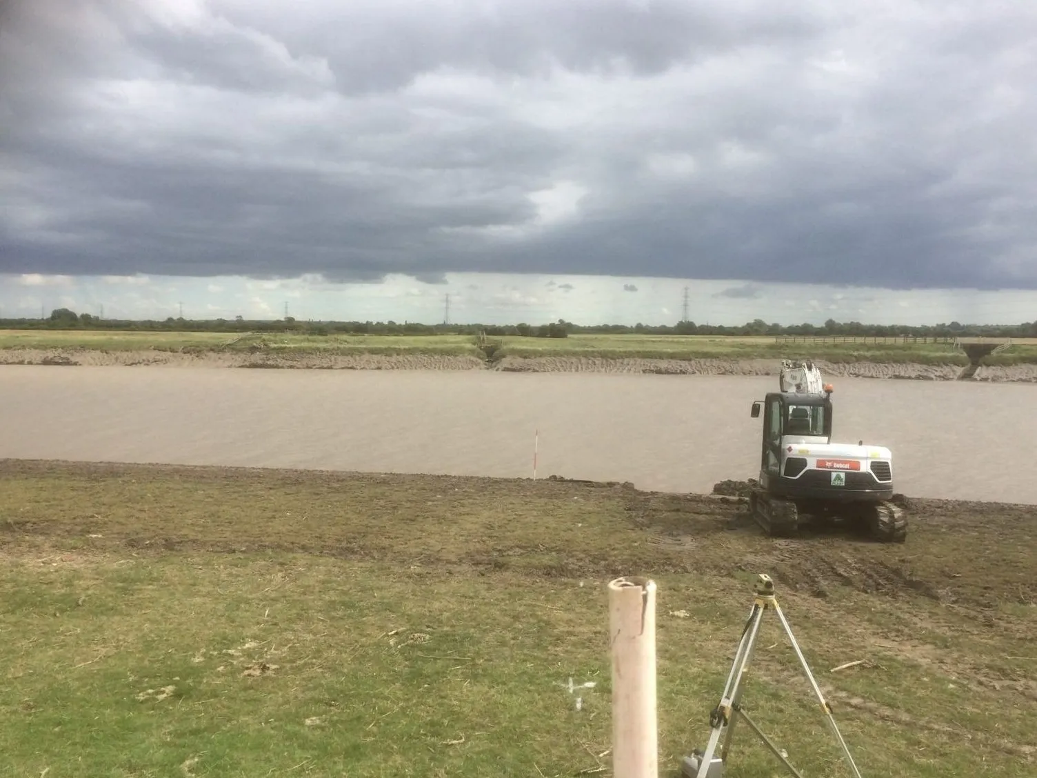
At Pawlett Hams near Bridgwater we directional-drilled a 252m, 355mm water main under the tidal River Parrett, around 5m beneath the bed, comfortably inside the FRA3 depth, and clear of the banks on each side. Restoring that supply meant the freshwater crossing had to be reliable for the long term and installed without opening up a tidal main river, which is exactly what a drilled crossing designed to the Environment Agency standard delivers. It is a worked example of a real main-river crossing taken from the regulatory conditions through to a finished, buried pipe.
You can see the job in full on our River Parrett crossing case study, and the wider picture on our rivers and watercourses page. If you have a river, canal or watercourse to cross, send us the details and we will show you how it would be drilled, what the approval needs, and what it is likely to cost.
Questions answered
Usually, yes. The Environment Agency controls work in, under, over or near a main river, the larger rivers and streams shown on its main river map. A service drilled beneath the bed of a main river is a flood risk activity, so it needs the Agency's agreement. The good news is that a trenchless crossing normally falls under exemption FRA3, which lets it be a simple online registration rather than a full permit, as long as the crossing is designed to meet the exemption conditions. We design it to stay within them from the start.
FRA3 is the Environment Agency exemption for "a service crossing below the bed of a main river not involving an open-cut technique", which is exactly a drilled crossing. Meet its conditions and the crossing is a registrable exemption, so no full Flood Risk Activity Permit is needed. The main conditions are: at least 1.5m below the bed for the whole length and for 5m beyond each bank, the bore within 10 degrees of perpendicular to the flow, the pits set back 8m from the bank (16m if tidal), no passing through a bank, culvert or defence, 50m clear of any impoundment, well clear of protected conservation sites (200m from an SSSI, SAC, SPA, Ramsar site or local nature reserve), permanent hazard markers on both banks, no disturbance to the bed and banks, and the exemption registered online before work starts. We design the crossing to hit all of them, because that is what keeps it a registration rather than a permit.
At least 1.5m below the bed, held for the whole length of the crossing and for 5m beyond each bank, to qualify for the FRA3 exemption. That 1.5m is the threshold to be exempt, not necessarily the right depth for the river. On a deep, wide or scour-prone river the Agency commonly wants more cover, driven by the scour depth and the bed profile, and it is set case by case. We confirm the required minimum with the Agency for the specific river, along with the datum it is measured from, the existing bed level or a calculated maximum scour level, and design the bore to suit.
Then a full Flood Risk Activity Permit is needed instead of the exemption, either a standard rules permit or a bespoke one. That is a determination, not a registration, so it takes time: the Agency normally decides within 2 months for a flood-risk-only application, or 4 months where it is combined with other activities or goes to public consultation, and there is an application charge. We build that window into the programme, hold a pre-application discussion with the Agency, and can make the application and provide the supporting design, or hand it to the client to take out with our design behind it.
An ordinary watercourse is one not designated a main river, the smaller streams, brooks and ditches. Those sit outside the Environment Agency's river permitting, so FRA3 does not strictly apply. Instead you need ordinary watercourse consent, land drainage consent, from the lead local flood authority, the county or unitary council, or the local internal drainage board where there is one. We design every watercourse crossing to the FRA3 minimum regardless of who consents it, because it is a proven standard for keeping the crossing well clear of the channel.
A canal is different again. The Canal & River Trust owns the canal network in England and Wales, the water, the bed, the banks and a margin of land each side, so a crossing beneath a canal needs their consent under their Code of Practice, applied for through the local Works Engineer, who will want an early site visit before anything is designed. The depth expectation is deeper than a river: the Trust's published figure is of the order of 3.5m below the hard bed to the crown of the pipe, varied by the Works Engineer for the ground and method, and the lead time is around 3 months, or longer if a navigation closure is needed. Their concern runs both ways along the bore: drilling fluid escaping up into the canal, and the canal water draining down through the bore into the launch and reception pits. So the design and method statement are built around not losing fluid into the canal, and the pits are set back from the water's edge with the top of the excavation kept above the canal's top water level, so any water that finds the bore is contained. Because canals often run along raised embankments above the surrounding ground, that is not always possible by digging alone, so where it is not, a bund is built around the pit to give the same containment.
Related services
How a river crossing actually runs, the early protected-site check, the real drilling depth, who registers, and what we need from you at each stage.
View service →Our river, canal and estuary crossings, and the real jobs behind them.
View service →The bore profile, bed survey and approval pack behind a registered crossing.
View service →Send us the watercourse, the service and the line you want, and we'll come back on the crossing, the Environment Agency approval and a budget price.