Est. 2005 · UK-wide trenchless installations07920 553 578·chris@swdd.co.uk
Design, Survey & Support
Measured ground and level surveys along the line of the crossing, so the bore is designed and set out to the real ground, not to assumed levels.
A bore is only as accurate as the ground model it is designed against. We carry out topographical and level surveys along the line of the crossing, capturing the real ground profile and site features so the design sets the bore to the right depth, cover and falls.
We match the equipment to the site and to the accuracy the job needs. That might be GPS / GNSS on an open route, a total station where we need tight control or there is no clear view of the sky, a survey drone to cover large or access-restricted ground quickly, or precise levelling where the falls on a gravity drain have to be exact. For dense vegetation, such as under a tree canopy where GNSS and a total station are not practical, a LiDAR drone can pick the ground out through the gaps in the cover. On most jobs it is a combination, with one method checking another.
Beyond a standard topographical survey we capture whatever a particular crossing needs. The survey can form the pre-works baseline that the surface is then monitored against during drilling, and where a bore runs under water we can take a bathymetric survey to profile the river or canal bed. Those bed levels are what let us design the crossing to the Environment Agency's FRA3 standard for drilling beneath a main river, keeping the bore the required depth below the bed for its whole length.
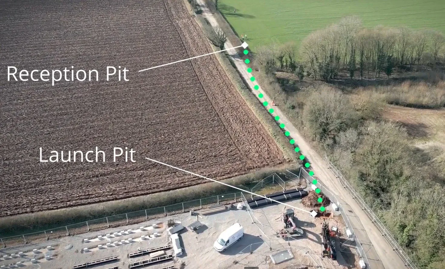
The survey then does double duty. We use it to set the launch, reception and line positions out on the ground, and after the job we record the installed line back to survey as an as-built. We supply the finished drawings in both .dwg and .pdf, so your designers can work straight from the CAD and everyone else can read the PDF. Everything ties to the OS National Grid and datum, so it lines up with your other drawings and any third-party records.
What you get
| Survey methods | GPS / GNSS, total stations, survey drones & precise levels |
|---|---|
| Route survey | Ground profile along the line of the bore, entry to exit |
| Set-out | Launch, reception & line positions marked on the ground |
| As-built | The installed line and levels recorded back to survey |
| Drawings | Supplied as .dwg and .pdf, ready for the bore design |
| Coverage | UK-wide · tied to OS National Grid & datum |
Already have a survey? We'll use it and check it against site, rather than charge you twice.
Questions answered
The bore is designed against the ground surface and the levels. A measured topographical survey gives us the real ground profile along the line, so the bore can be set to the right depth, cover and falls rather than to assumed levels. For gravity drainage in particular, where the pipe has to run to falls, accurate levels are the difference between a drain that works and one that doesn't.
Yes. We carry out topographical and level surveys along the line of the crossing, using GPS / GNSS, total stations and survey drones to suit the site, set the launch and reception positions out on the ground, and tie everything to the OS National Grid and datum. We can also work from a survey your own team or consultant has already done.
Yes. Where a bore runs beneath a river or canal we take a bathymetric survey to profile the bed, alongside the topographical survey of the banks. Those bed levels are what let us design the crossing to the Environment Agency FRA3 standard for drilling beneath a main river, which sets a minimum depth below the bed for the whole length of the bore. Without an accurate bed profile you cannot prove the crossing meets it.
Both editable CAD and PDF. You get the drawings as .dwg files your designer can work straight from, and .pdf copies anyone can open, all tied to the OS National Grid and datum.
Yes. We record the installed line and levels back to survey so you have an accurate as-built of where the bore actually went, which matters for records, future works and any third-party assets nearby.
Then we will use it. We will sense-check the levels against what we see on site, but there is no need to pay for a survey twice. Send us what you have and we will tell you whether it covers what the design needs.
Related services
The bore profile and layout the survey data feeds straight into.
View service →Finding what is buried along the line, not just the shape of the ground above it.
View service →Where accurate levels matter most, on gravity pipe run to falls.
View service →Tell us the line of the crossing and we'll survey the route, set it out and feed the levels straight into the bore design.